[Scott Tilley] was searching for radio signals from the Air Force’s top-secret ZUMA satellite. He found something that is — we think — much more interesting. He found NASA’s lost satellite called IMAGE. You are probably wondering why it is interesting that someone listening for one satellite found another one. You see, NASA declared IMAGE dead in 2005. It went silent unexpectedly and did not complete its mission to image the magnetosphere.
NASA did a failure review and concluded that in all likelihood a single event upset caused a power controller to trip. A single event upset, or SEU, is a radiation event and should have been automatically recovered. However, there was a design flaw that failed to report certain types of power controller failures, including this one.
The report mentioned that it might be possible to reset the controller at a specific time in 2007, but given that NASA thought the satellite was out of commission that either never occurred or didn’t work. However, something apparently woke the satellite up from its sleep.
[Scott] did a lot of number crunching to determine that the satellite’s spin rate had only decreased a little from its operational value and that the doppler data matched what he expected. [Scott] can’t read or command the telemetry, so he doesn’t know how healthy the satellite is, but it is at least operational to some degree. It’s really neat to see members of the team that worked on IMAGE leaving comments congratulating [Scott] on the find. They are working to get him data formatting information to see if more sense can be made of the incoming transmissions.
Who knew listening to satellites could be so exciting? If you want to build your own ground station, you might be interested in this antenna mount. If you need to know what’s overhead, this can help.


You make it sound like IMAGE as a big failure but it actually was a success because it ran for almost six years before it failed. I’m always impressed by these machines that take such brutal punishment yet keep functioning, even if there are hiccups.
Opposite of most consumer electronics.
That’s because people don’t want to pay satellite prices for consumer electronics.
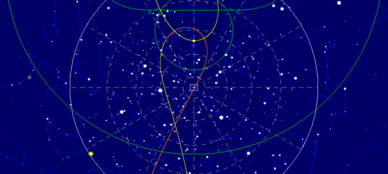
I have trouble interpreting the charts/spectrum displays on the link.
but it sounds impressive!
Good luck in talking to Zuma, https://www.businesslive.co.za/bd/world/americas/2018-01-10-lost-zuma-satellite-comes-at-an-awkward-time-for-elon-musk-and-spacex/
As I recall it was the sat that was bad but the launch was OK according to Musk.
So not his problem then.
Plus military sats don’t talk back to the targe.. I mean public.
“Plus military sats don’t talk back to the targe.. I mean public.”
B^)
Between what IS and what is NOT said–at a risk of sounding conspiratorial–it is possible the secret satellite DID make it to it’s intended orbit (which is not what was advertised) for the purpose of monitoring North Korea, Russia, Iran, ISIS, … So looking for it is not that out there. I mean, hey, NASA, who knew where IMAGE was and how to communicate with it seemingly had not realized it was functioning again. If the government can discourage people from looking, it can hide ZUMA in plain sight.
I had the same idea. With such a highly classified mission it does not need even to be true, when they say it’s lost. Declare it dead and enjoy it’s secret life.
I’d chalk that up to bureaucracy. NASA never has the budget they want for the projects they’re tasked with so the IMAGE team were probably doing other ‘more productive’ things since officially the satellite was dead.
Hiding in plain sight only works if no one is looking. There is a small but active community of people who spend their nights satellite hunting, every couple years somebody discovers a satellite that isn’t on any of published orbit charts. I can only imagine the US and it’s competitors have teams of people with far better equipment doing the same thing.
I think it would be hard to hide the satellite. Maybe to amateurs, but not to governements. In fact there are three countries (that I konw of) that are capable of tracking satellites in orbit :
-the US, with the NORAD* publishing daily updates on satellite trajectories. OK, they might not publish some data
– the Russians, for example with the Krona radars.
-the Europeans, for example with the French GRAVES radar (it can be used to listen to meteors :) ).
So I don’t think that you would be able to hide a satellite for that long; to the public, yes, but not to another country.
*I am a little confused here by the structure of the DoD and its relationship with NORAD: who owns the system ? Which organization is part of which ? But that’s not really important.
The DoD (Department of Defense) is the Department that oversees the Air Force, the Army, and the Navy, (the Marines are a department of the Navy). NORAD is a department of the Air Force, therefore the DoD (through the Air Force) “owns” the system. The Coast Guard is under the Department of Homeland Security.
I used to work at an Air Force Base that tracked satellites, but that particular site had its limitations (range, size of target, scanning area) so I am not sure if it was able to track “deep space” satellites or Geo-stationary sats.
Thanks for the explanation :)
I think I got confused because of the orgnazation by region, function and by “type” of the US military. Between the NORAD and the US Space Surveillance Network ther was: USSTRATCOM, USNORTHCOM and US Air Force. But it’s clear now. In fact, I had never looked up precisely what was the actual organization and I din’t want to say something wrong.
Anyway, I only ever used the data from the NORAD for a school project and it was quite nice to have :)
That’s nice :) Was it an optical tracking system or a radar ? (If that’s not too much to ask)
Last I knew the Canadian Air Force was also involved with NORAD. I checked Google and here is a link: http://www.norad.mil/About-NORAD/Canadian-NORAD-Region/
Dad used to say they’re always watching me… so if you don’t believe in God… there’s satellites then and they know… not just Santa Claus. Check this website out for tracking Santa Claus… and we’d look for a few years with us kids around Christmas time going online back in the dial-up days of free internet.
Phased array radar
https://en.wikipedia.org/wiki/Cavalier_Air_Force_Station
There are others who have synthetic aperture arrays and I want to say synthetic aperture phased arrays also. NRO has constellations, though along with the ODNI… I am not sure the details of the 17 public agencies disclosed for non-official use. I’d have to research some more and haven’t lately.
The NRO used to have more information, though like the NSA they took down their launch and station information from the public that used to be readily disclosed. NSA removed back in the early 2000’s. NRO removed some launch info I want to say last year.
Here is a general link: https://www.dni.gov/index.php/what-we-do/members-of-the-ic
Note that the DOT even has satellite operations and I want to say some State Police even. I recall in the late 90’s a Congresswoman (of course) wanting to issue speeding tickets using satellites. That was shot down… still. The satellites were not.
I’d guess priorities and time available for experiments and missions. Seems even the radio telescopes can detect if they target discriminate for.
“Good luck in talking to Zuma”
I don’t think he ever mentioned “talking” to Zuma…
just listening to/for it.
Uh, its not Zuma.
Zuma went as planed. It was trade goods to the Aliens.
They got tiered of coming down to us. So they said you send it up to us this time.
Not to be confused with Zima…
B^)
https://en.wikipedia.org/wiki/Zima_(drink)
Great topic and inspirational article where more hackers that can study amateur/professional radio can get into assessing for the public, what is “lost in space.”
I’d like to add some links on a sat com antenna like here: https://forums.radioreference.com/satcom-space-satellite-monitoring-forum/352085-homemade-satcom-antenna.html
Or like here: https://hackaday.com/2017/01/02/junkyard-dish-mount-tracks-weather-satellites/
https://www.instructables.com/id/Make-a-Radio-Telescope-With-Raspberry-Pi/?utm_source=newsletter&utm_medium=email
Or like here if you’re really ambitious and want to make an antenna farm: https://ece.illinois.edu/about/history/antenna/photos.asp
Here another system that is interesting that is not as directional as Mr. Tilley’s system I’m guessing… though is used as a radio telescope and can be tuned for higher frequency work though are designed for lower frequencies (the NASA Goddard reference reminded me):
https://radiojove.gsfc.nasa.gov/ (see educational materials)
I’ll not this VLF system and if anyone else is aware of others, please reference:
http://theinspireproject.org/ (not as relevant, though interesting if designed more advanced)
Apparently former members of the NASA IMAGE team are working to contact it via the DSN, then setup a minimal ops to see if it’s still viable:
http://www.satobs.org/seesat/Jan-2018/0192.html
Fun fact, the power supply reset that affected IMAGE also affected EO-1 and WMAP, since they used the same power supply module, but they both recovered.
Wasn’t it Mr. Meat Loaf who, back in 1977, said, “Two Out Of Three Ain’t Bad”
Now that’s a fun fact. B-)
Especially compared to the early failures of the Discoverer and Corona programs: https://en.wikipedia.org/wiki/Corona_(satellite)